





Severe storms with damaging winds pushed through eastern Iowa on Friday night.
The Storm Prediction Center had put the area under a Level 3 Enhanced Risk for severe weather – and it didn’t take long for those storms to start popping up in the early evening.
That’s Delaware County Emergency Management Coordinator Mandy Bieber, who says there were several reports of damage after the storms moved through.
Power outages have been reported too.
Elsewhere around the area, trained spotters reported ongoing 80 to 90 mph winds lasting for several minutes in the Cedar Rapids/Hiawatha area with zero visibility. The National Weather Service received a report of downed trees throughout Monticello. And a tornado was reported to have crossed Highway 61 near Andrew in Jackson County.
A tornado warning was issued for southeast Dubuque County, with a radar-indicated rotation near the Dubuque Regional Airport. Quarter-sized hail fell at the Dubuque County fairgrounds, where the Dubuque County Fair is taking place this week. The fair initially delayed Friday night’s Skillet/Theory of a Deadman concert before deciding to cancel the show altogether due to the severe weather.Â
Bieber says there was a report of a possible funnel cloud in the Delhi area on Friday night, but they’re hoping to get a little more information.
And if you have any other storm or damage reports to pass along, please share those with Delaware County Emergency Management.
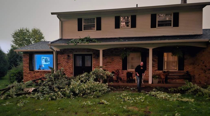
top photo courtesy of Kassie Gonzalez (Manchester); bottom photo courtesy of Jeff Elliott (Jefferson Road)
Stay Connected with 94.7 KMCH
Add 94.7 KMCH as a preferred source on Google to see more local news, weather, and sports in your feed.
Follow us on Facebook for breaking news, severe weather alerts, sports, and more.
