





After several rounds of severe weather this past week, there is another chance for severe storms today – though it is a low one.
The National Weather Service says another fast-moving storm system will bring a 40 to 60 percent chance of storms to eastern Iowa this afternoon. Most of the area is at a Level 0 out of 5, but the eastern half of Dubuque County and portions of Illinois and Wisconsin are at a Level 1.Â
Strong, gusty winds and up to quarter-sized hail would be the biggest threat with these severe storms if they develop. Downpours and reduced visibility are possible too.
Stay with KMCH – we’ll let you know of any watches and warnings and break in with live coverage as needed.
Monday afternoon’s severe storms brought accumulating hail to Fairview around the Anamosa area – looking just like a light layer of snow on the ground. Half-dollar sized-hail was reported in Stone City, with ping-pong ball sized-hail reported just west/southwest of Rowley.
The National Weather Service says Wednesday and Thursday are expected to be dry, with showers in the forecast Friday into Saturday and more storms possible Sunday into Monday.
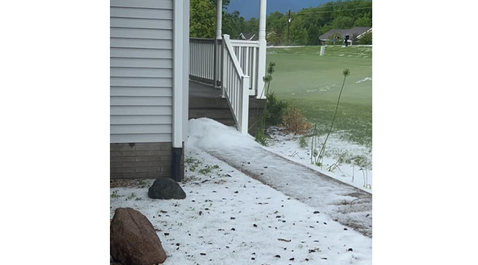
photo courtesy of Drew Haag/NWS
Stay Connected with 94.7 KMCH
Add 94.7 KMCH as a preferred source on Google to see more local news, weather, and sports in your feed.
Follow us on Facebook for breaking news, severe weather alerts, sports, and more.
