




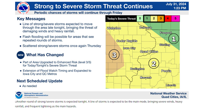
Strong to severe storms are possible tonight into Thursday.
The Storm Prediction Center has placed most of eastern Iowa under a Slight Risk (Level 2 out of 5) for today. Areas west of Waterloo, Cedar Rapids and Iowa City have been upgraded to a Moderate Risk (Level 3 out of 5).
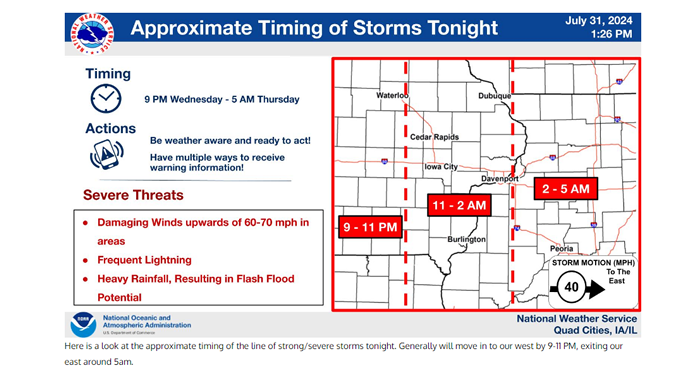
The National Weather Service says damaging winds, large hail and frequent lightning would be the biggest threats if the storms develop tonight into Thursday. Flash flooding is also possible for areas that see repeated rounds of storms through Friday.
Areas less impacted by storms will see very hot and humid conditions.
Stay Connected with 94.7 KMCH
Add 94.7 KMCH as a preferred source on Google to see more local news, weather, and sports in your feed.
Follow us on Facebook for breaking news, severe weather alerts, sports, and more.
