





Severe weather remains a threat as we head into the late afternoon and evening hours across eastern Iowa.
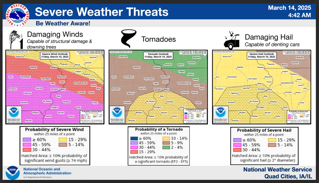
The Storm Prediction Center has placed much of the KMCH listening area – including Delaware, Dubuque, Buchanan, Jones, northern Linn and southern Fayette and Clayton counties under a Level 3 Enhanced Risk for severe storms. The southwest portion of the listening area, including southern Linn County, has been upgraded to a Level 4 Moderate Risk. The northern portions of the listening area, including northern Fayette and Clayton County, are under a Level 2 Slight Risk.
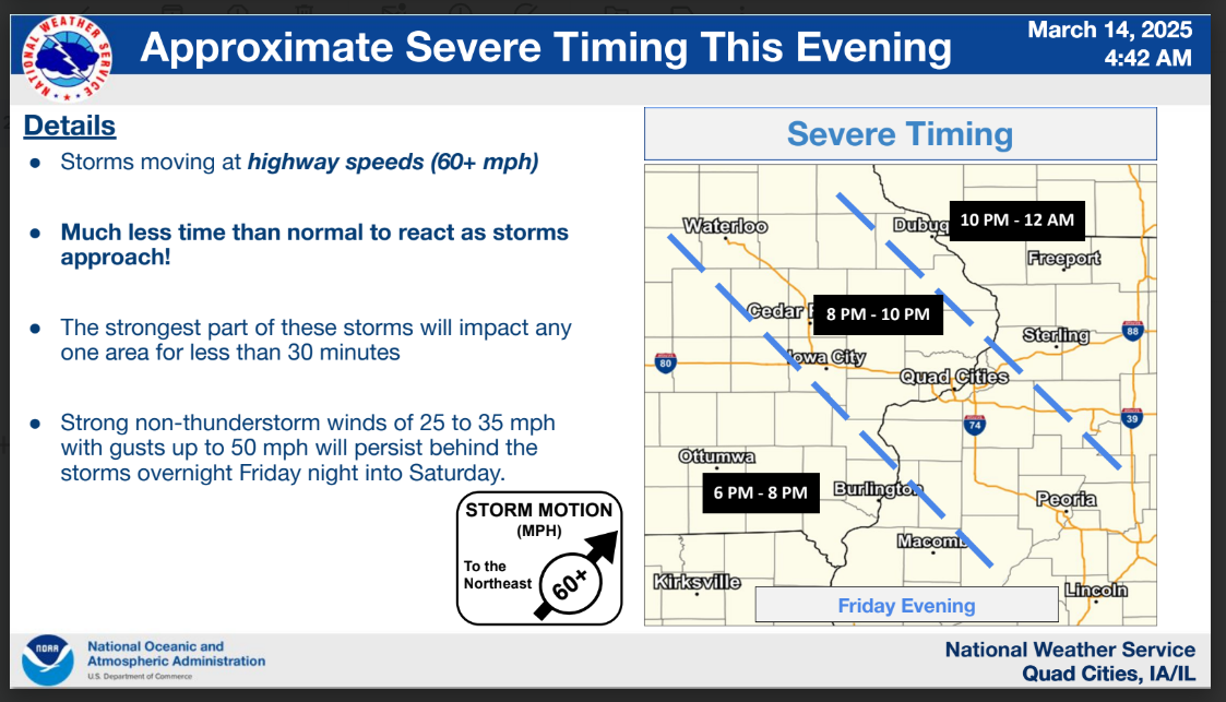
The National Weather Service says the line of storms will move through quickly at highway speeds of 60+ miles per hour, so there won’t be as much time to react as there typically is with storms. The most likely timing for the storms to arrive would be between 7 and 10 pm tonight, with the strongest part of these storms impacting any one area for no more than 30 minutes. Damaging winds between 60 to 80 miles per hour would be the main threat, capable of structural damage and downed trees. Tornadoes and damaging hail are also possible.
Stay weather aware as we head into the evening and have a way of receiving alerts if warnings are issued. Mix 94.7 KMCH will break in with live coverage if any severe thunderstorm warning or tornado warnings are issued.
Stay Connected with 94.7 KMCH
Add 94.7 KMCH as a preferred source on Google to see more local news, weather, and sports in your feed.
Follow us on Facebook for breaking news, severe weather alerts, sports, and more.
