





The weather could bring us a little bit of everything on Wednesday.
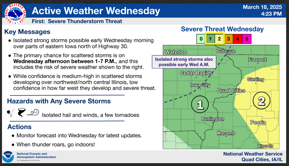
The National Weather Service says scattered showers and thunderstorms are possible early Wednesday morning, with a Marginal Risk, level 1 of 5, for severe storms. The primary threats will be isolated large hail and frequent lightning, though a few tornadoes are also possible.
As the day goes on, more showers and thunderstorms are expected, especially along the cold front that sweeps through the area during the afternoon and evening. Some of these storms may be strong to severe, with all hazards possible. The Storm Prediction Center highlights much of our area in a Marginal Risk, level 1 of 5, for severe weather, with a Slight Risk, level 2 of 5, for parts of western Illinois.
Cold air quickly moves in behind a cold front Wednesday evening and night, with a transition from rain to snow expected. Much of the area should see less than an inch of snow, with upwards of two inches possible. Strong winds accompanying the snow will result in periods of reduced visibility.
Stay with KMCH for the latest weather updates.


Stay Connected with 94.7 KMCH
Add 94.7 KMCH as a preferred source on Google to see more local news, weather, and sports in your feed.
Follow us on Facebook for breaking news, severe weather alerts, sports, and more.
