



Torrential Rains, Flash Flooding, Severe Storms Hit Eastern Iowa
Over Four Inches Fell in Manchester Friday

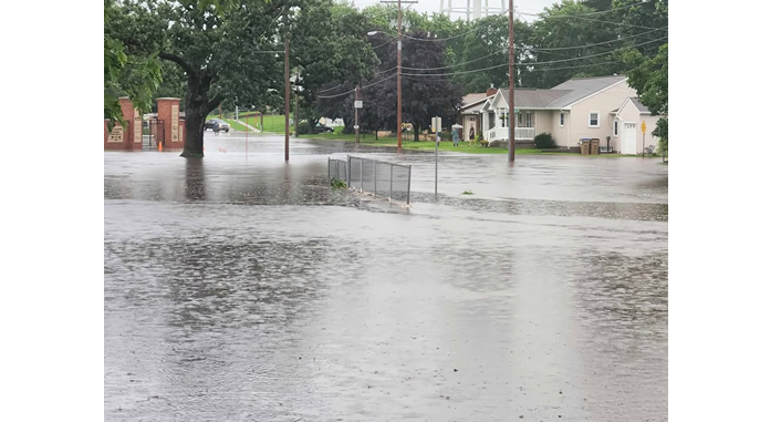
Torrential rains, severe storms and flash flooding hit eastern Iowa on Friday.
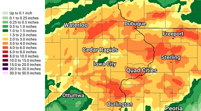
The National Weather Service says as much as four to six inches of rain fell across eastern Iowa during those two days, with the majority of the rain coming on Friday. Our rain gauge at the KMCH Studios in downtown Manchester recorded five inches of rain the past two days – 0.75” on Thursday and 4.24” on Friday.
Severe thunderstorms moved through Delaware and Dubuque counties early Thursday evening. Pioneer Agronomist Troy Deutmeyer reported light crop damage in the Petersburg area, where a Tornado Warning was issued by the NWS due to radar-indicated rotation in the storm, which continued moving east. A tornado was not spotted nor confirmed.
On Friday, consistent rain and thunderstorms impacted the area. A lightning strike at the Delaware County Fairgrounds shortly before 1:30 pm on Friday damaged four vehicles in the north parking lot north of the Beef Barn. The Manchester Fire Department says no one was injured.
Severe thunderstorms developed across Buchanan, Delaware, Dubuque, Linn and Jones counties late Friday afternoon, prompting numerous Severe Thunderstorm Warnings – with some warning of a threat of 70 to 90 mile per hour wind gusts.
Several Tornado Warnings were also issued for the Delaware, Dubuque, Linn and Jones county areas, with rotation indicated in the storm on radar. There were no confirmations of a tornado in those areas.
Storm reports from Friday received by the National Weather Service include:
- Walker – mobile home damaged and trees snapped (reported by trained spotter)
- Independence – flash flooding, with vehicles stranded (reported by public)
- Independence – water halfway up the tires on cars (reported by trained spotter)
- Northern Linn County – widespread reports of trees down (reported by Emergency Management)
- Near Center Point – semi blown over on I-380
- 3 Miles Southeast of Buck Creek – shed blown down, large tree uprooted at farmstead (reported by trained spotter)
- 1 Mile South/Southwest of Cascade – possible wind gusts up to 90 mph (reported by Emergency Management)
- Bernard – numerous trees down, main road in town blocked (reported by public)
Storm reports from Friday received by Delaware County Emergency Management:
- Crops laid flat near Greeley
- Machine shed blown over near Hopkinton
- Bernard Fire Department lost their station
- Dubuque County Secondary Roads Department lost a building
Storm reports from Friday received by KMCH:
- Wind damage across Monticello
- Power out in Coggon
- Petersburg Blacktop covered with water north of Petersburg
- Numerous reports of flash flooding across Manchester, including on Gay Street, Doctor Street, Clara Avenue, Fairview Drive, Stiles Street, North Fork/Quaker Mill, Prospect Street, Sherman Avenue and the Beckman Sports Complex
Emergency personnel had several streets in Manchester blocked off on Friday night as the streets filled with water. Manchester Fire Chief Randy Rattenborg tells KMCH that by Saturday afternoon, the flash flooding had receded and was no longer causing any issues. Rattenborg says it appears the Baum Park area, Stiles Street and the area from Brown Field north to Acers Street took the biggest hit from Friday’s flash flooding.
The Delaware County Fair, taking place this week in Manchester, was asking fairgoers to avoid parking in the fairgrounds’ parking lot, with those attending Friday night instead parking on side streets just outside the fairgrounds. The fair’s Scotty McCreery concert was held after the rain and storms passed (minus the opening act), with the country singer taking the stage at 9 pm. Parking is limited today in the fairgrounds’ north parking lot – please utilize street parking as much as possible (south of fairgrounds is best option).
On Friday night immediately following the storms, Delaware County Engineer Rafe Koopman was asking the public to use caution on the roadways, as many roads were washed out from the rain, with trees also downed from the storm. He says county road crews were working to get to them as fast as they could.
Also on Friday night, Delaware County Conservation announced they were experiencing high water at Bailey’s Ford Campground south of Manchester. Campers were asked to evacuate lower Bailey’s Ford. Coffins Grove and Twin Bridges Campground were also under watch for high water.
The Maquoketa River in Manchester jumped from 4.5 feet to over 13 feet within 24 hours. As of Saturday afternoon, it was at 13.5 feet – just below the 14-foot flood stage – flowing at over 4,600 cubic feet per second (to put into perspective, this week’s flow was averaging around 250 cfs). The National Weather Service says area rivers are forecast to gradually rise due to widespread heavy rainfall over the last few days, including the Mississippi, Wapsipinicon, North Skunk, English, and Iowa Rivers. There are currently no Flood Warnings in effect for the KMCH listening area.
The forecast is calling for drier and quieter weather through Tuesday afternoon.
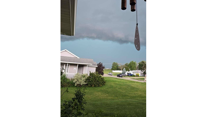
Northwest of Monticello (Meleah Luensman)
Rainfall totals from Thursday & Friday (NWS)
Rain gauge in Manchester (Cade Gonzalez-Orr via NWS)

West Delaware High School area in Manchester (Monica Bailey)
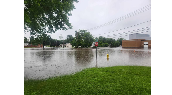
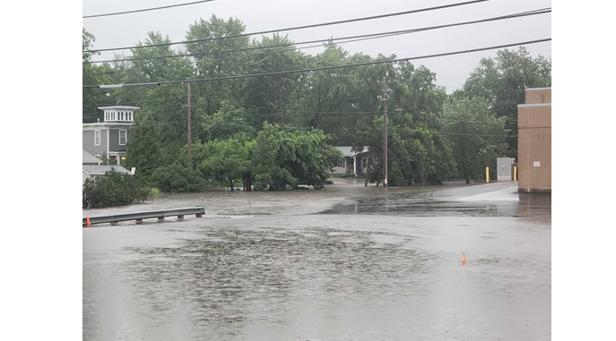
Fairview Drive in Manchester (Jamie Vaske)

Beckman Sports Complex in Manchester (Mikaela Rans)
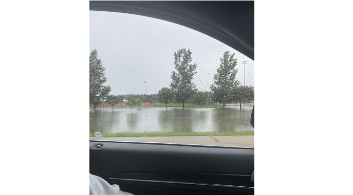
contributed photos
Stay Connected with 94.7 KMCH
Add 94.7 KMCH as a preferred source on Google to see more local news, weather, and sports in your feed.
Follow us on Facebook for breaking news, severe weather alerts, sports, and more.
