




Severe weather is possible in eastern Iowa today.
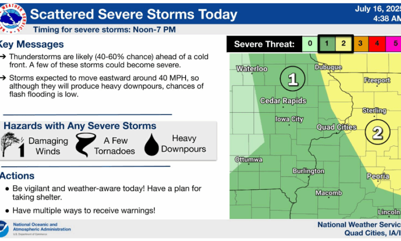
The Storm Prediction Center shifted the larger threat just slightly farther to the east, with the far eastern edge of the KMCH listening area – including eastern Dubuque County – under a Level 2 out of 5 Slight Risk for severe weather, with the rest of eastern Iowa under a Level 1 out of 5 Marginal Risk.
The National Weather Service says thunderstorms are likely ahead of a cold front on Wednesday and some of those storms could turn strong to severe. The most likely timing for severe storms will be in the afternoon and early evening. Damaging winds and a few tornadoes are the main threats, with heavy downpours the secondary threat. Storms are expected to move eastward around 40 miles per hour, so although they will produce heavy downpours, chances of flash flooding is low.
Stay with KMCH – just like last Thursday and Friday, we’ll let you know if any watches or warnings are issued and break in with live coverage if severe weather develops.
image courtesy of NWS
Stay Connected with 94.7 KMCH
Add 94.7 KMCH as a preferred source on Google to see more local news, weather, and sports in your feed.
Follow us on Facebook for breaking news, severe weather alerts, sports, and more.
