




This post is valid for Tuesday, April 14th.
Severe weather is a threat today and tonight.
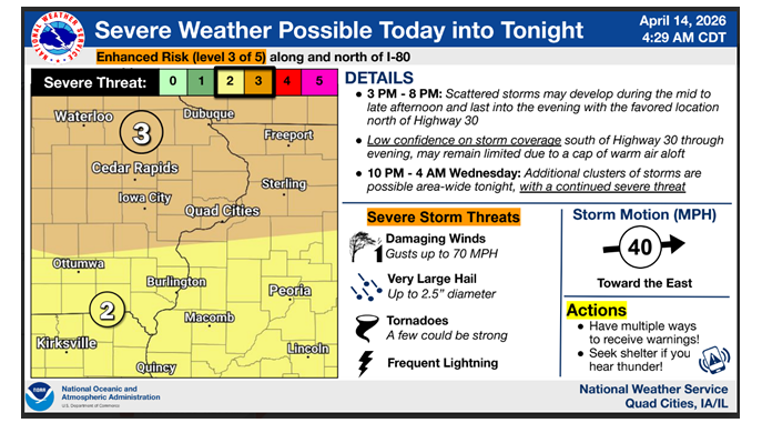
The National Weather Service says there is a Level 3 out of 5 Enhanced Risk for severe storms along and north of the I-80 corridor – that includes all of the KMCH listening area (Delaware, Dubuque, Jones, Linn, Buchanan, Fayette and Clayton).
All modes of severe weather will be possible – frequent lightning, damaging winds with gusts up to 70 mph, very large hail up to two-and-a-half inches in diameter (up to tennis ball size) and tornadoes (a few could be strong).
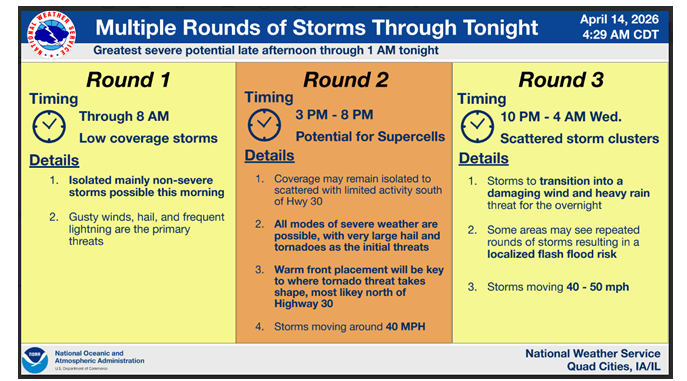
Scattered storms with the potential for supercells may develop during the mid to late afternoon from roughly 3 to 8 pm and last into the evening. Additional clusters of storms are possible area-wide tonight from roughly 10 pm to 4 am, with a continued severe threat, with damaging winds and heavy rain. Some areas may see repeated rounds of storms tonight, which could result in localized flash flooding.
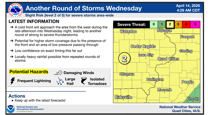
Eastern Iowa could see more rounds of strong to severe storms Wednesday and Friday. The National Weather Service says eastern Iowa is under a Level 2 out of 5 Slight Risk on Wednesday.
images courtesy of NWS
Stay Connected with 94.7 KMCH
Add 94.7 KMCH as a preferred source on Google to see more local news, weather, and sports in your feed.
Follow us on Facebook for breaking news, severe weather alerts, sports, and more.
