




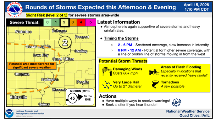
Another round of strong to severe storms is expected this afternoon and evening.
The National Weather Service says eastern Iowa (including all of the KMCH listening area – Delaware, Dubuque, Buchanan, Jones, Linn, Clayton and Fayette counties) is under a Slight Level 2 out of 5 Risk on Wednesday. All modes of severe weather are possible, including damaging winds 60 mph or greater, large hail up to two inches in diameter, a few potential tornadoes and localized flash flooding (especially for the areas that have recently seen heavy rainfall).
Tune in to Mix 94.7 KMCH – we’ll let you know if any watches or warnings are issued and break in with live local coverage if severe weather develops.
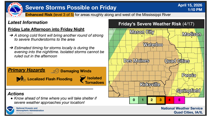
More severe storms are expected on Friday into Friday night. The National Weather Service says Friday’s set-up could be similar to Tuesday’s storms, with all of the KMCH listening area under an Enhanced Level 3 out of 5 Risk. The primary risks appear to be damaging winds, isolated tornadoes and localized flash flooding. As of right now, the timing for Friday appears to be late Friday afternoon into the nighttime hours.
Rounds of heavy rainfall are causing area rivers to rise, with some flooding expected.
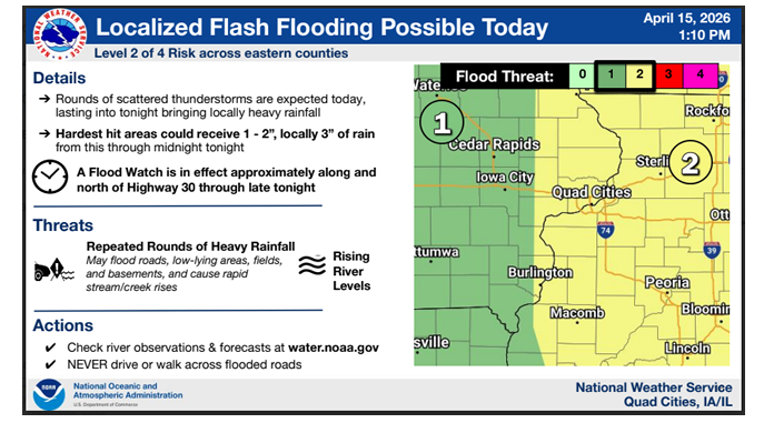
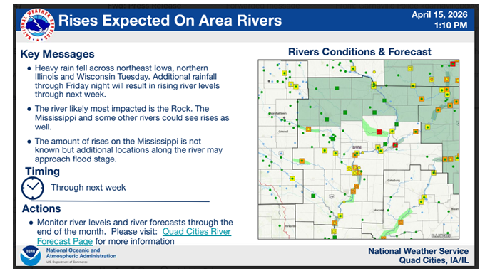
images courtesy of NWS
Stay Connected with 94.7 KMCH
Add 94.7 KMCH as a preferred source on Google to see more local news, weather, and sports in your feed.
Follow us on Facebook for breaking news, severe weather alerts, sports, and more.
