




Severe weather will be a threat as we move through the next few days.
There is a Level 1 out of 5 Marginal Risk tonight into the overnight (with damaging winds the primary threat), but a better chance will come tomorrow and Thursday.
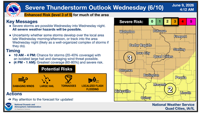
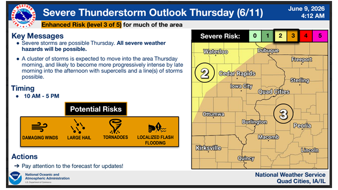
The National Weather Service says Wednesday and Thursday brings a Level 3 out of 5 Enhanced Risk for severe storms.
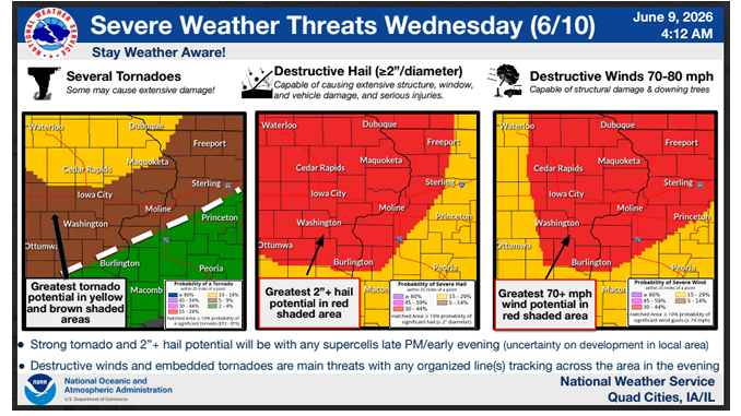
Wednesday’s best chances for storms appear to be in the afternoon to overnight hours, with a well-organized complex of storms likely. Strong tornadoes and large hail two inches or greater in diameter are possible with any supercells late afternoon/early evening. Destructive winds of 70 to 80 miles per hour and embedded tornadoes are the main threats with any organized line(s) tracking across the area Wednesday evening.
On Thursday, a cluster of storms is expected to move into the area in the morning and likely to become more progressively intense by late morning into the afternoon with supercells and a line of storms possible. The biggest threat on Thursday would be damaging winds, large hail, tornadoes and localized flash flooding.
Delaware County Emergency Management is urging everyone to stay weather aware and have multiple ways to receive alerts.
Keep it tuned to KMCH – we’ll let you know if any watches or warnings are issued and break in with live coverage if severe storms develop.
images courtesy of NWS
Stay Connected with 94.7 KMCH
Add 94.7 KMCH as a preferred source on Google to see more local news, weather, and sports in your feed.
Follow us on Facebook for breaking news, severe weather alerts, sports, and more.
