




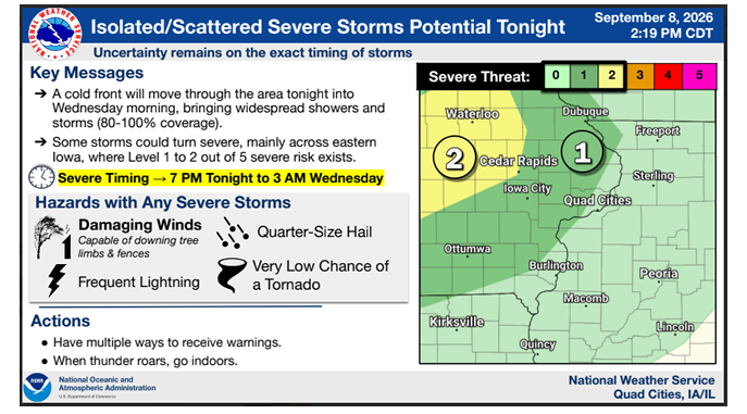
Strong to severe storms are possible across eastern Iowa tonight into early Wednesday.
The National Weather Service says the western portion of the KMCH listening area (Buchanan and western Linn and Fayette counties) are under a Level 2 out of 5 Slight Risk for severe weather, with the remainder of the listening area under a Level 1 out of 5 Marginal Risk.
The NWS says the main threats tonight are damaging winds (capable of downing tree limbs and fences), quarter-sized hail, frequent lightning and a very low chance of a tornado.
Delaware County Emergency Management notes that:
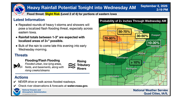
- Rainfall will be heavy and 3+ inches isn’t out of the question, which may cause streets and dry runs to flood.
- Damaging winds will be the primary threat for our area.
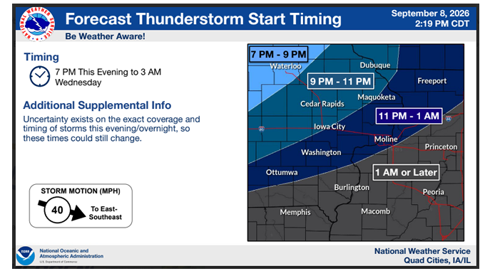
- Timing for our area is expected to be 9-11 pm, but we will see rain showers before this.
If you are at the Delaware County Fairgrounds for the State Fire Convention or know someone who is – the shelter is the Rec Center, just inside the main gate.
images courtesy of NWS
Stay Connected with 94.7 KMCH
Add 94.7 KMCH as a preferred source on Google to see more local news, weather, and sports in your feed.
Follow us on Facebook for breaking news, severe weather alerts, sports, and more.
