


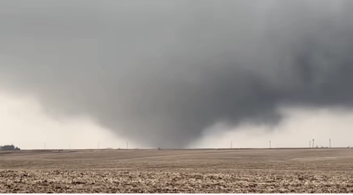
It’s pretty rare for the National Weather Service to issue a Tornado Warning in January – and it’s even more rare for a tornado to actually touch down right in the middle of winter.
On Monday afternoon, a couple tornado touchdowns were reported in eastern Iowa just south of the KMCH listening area.
The first tornado was reported by a trained spotter two miles north/northeast of Williamsburg shortly after 2 pm. Emergency management reported the tornado had blown over a semi at the Williamsburg exit on I-80.
A brief tornado was also reported nearly an hour later around 2:50 pm by a storm chaser three miles north/northwest of Ely.
The National Weather Service also received several reports of pea-sized hail. Hail slightly smaller than pea-sized fell in downtown Manchester late Monday morning, with a few claps of thunder as well.
And we could be transitioning from rain, thunderstorms and tornadoes to snow by mid-week. Our next storm system is expected to move into eastern Iowa late Wednesday night into Thursday morning. A sharp gradient in snowfall accumulations is expected, so a shift in the track of the system will mean those snowfall predictions could change – so stay tuned over the next 24 hours as those forecasts are updated.
video courtesy of Corey Bull/Iowa Storm Chasing Network