


This is Severe Weather Awareness Week – a time to learn a little more about severe weather and how to prepare and react if severe weather moves into your area.
And with the threat of severe storms on Friday, Delaware County Emergency Management Coordinator Mandy Bieber says it’s especially important to have a plan in place.
One important thing to be aware of everywhere you go – know where you would take shelter, whether you’re at work, home, shopping, traveling or outside.
It’s also important to have a way to get weather alerts.
Once again, if you’d like to start receiving weather alerts for your area, you can text DelawareIA to 67283 (or whichever county you live in – for example, BuchananIA or DubuqueIA). And Bieber recommends making sure your phone is charged and to maybe have a couple backups too.
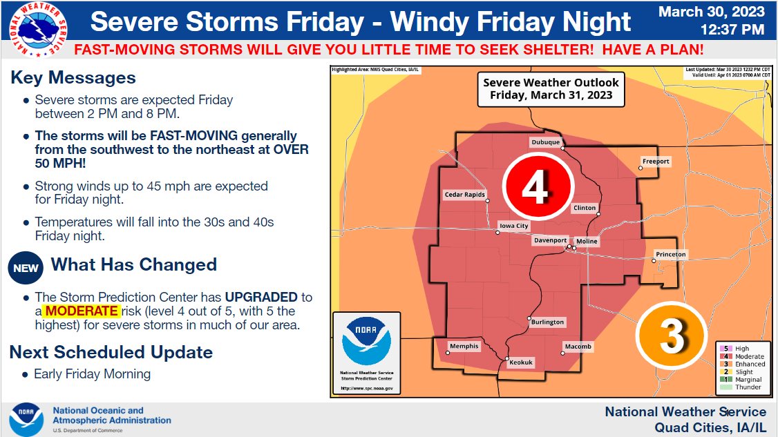
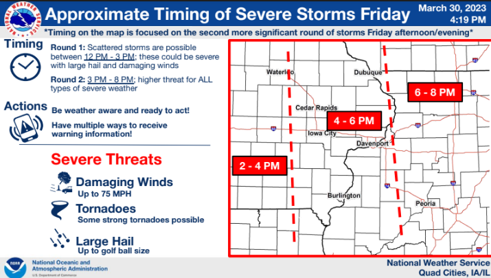
Friday’s severe weather threat has been upgraded by the Storm Prediction Center to a Level 4 Moderate Risk, which isn’t a level seen often in eastern Iowa. The National Weather Service says the biggest threats would be damaging winds up to 70 miles per hour, large hail up to ping-pong ball size and strong tornadoes. Severe weather is possible between noon and 8 pm (mostly likely for the KMCH listening area between 4 and 6 pm) – and storms will be moving very quickly at around 60 miles per hour. Because of the timing of the forecasted severe storms, the West Delaware School District will be watching the weather closely in case their dismissal plans need to be adjusted.
Keep it tuned to Mix 94.7 KMCH on Friday – we’ll let you know of any watches and warnings and break in with live weather coverage as needed. You can stream live on kmch.com. You can also download the KMCH app – click here for Apple or Android phones – or listen on Alexa.